The Anatomy of a Local Plan: Aim, Trade-Off and Next Step
Learn how to read a local plan by distinguishing its stated aim from the choices it makes, then identify the public record that will show what happens next.
A local plan can promise safer access while leaving the route, crossings, and approval process undecided. To read a local plan clearly, look at how its stated goal shapes a real choice in your community, not just at the language used to describe the future.
This approach is useful for plans about streets, parks, libraries, and other shared places. It shifts attention from broad claims to the decisions residents can see and discuss: what may change, who is affected, and what evidence will appear in the public record.
A local plan turns a goal into choices
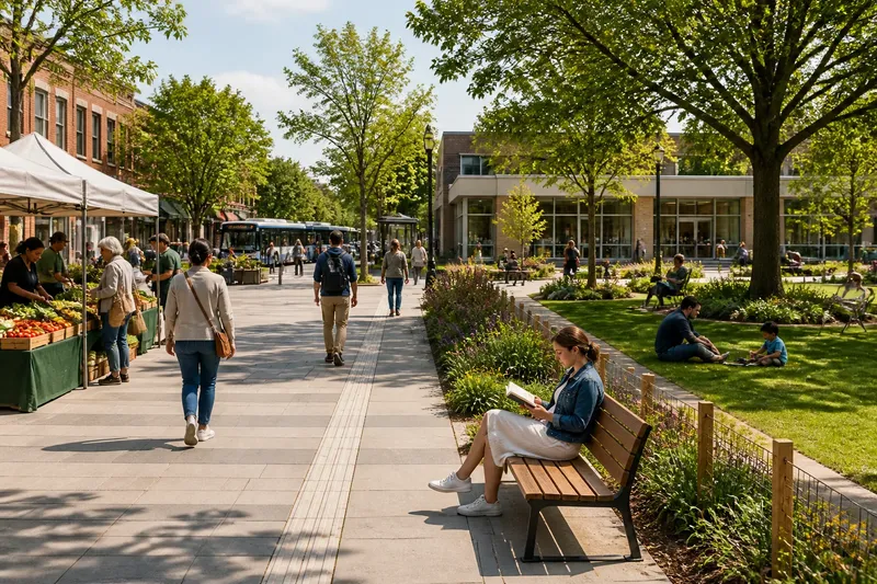
Find the goal, then connect it to a physical or service change. If a plan aims to make a town center more welcoming, ask whether it proposes seating, accessible paths, safer crossings, or support for storefront activity. The words “welcoming” or “vibrant” do not answer that question by themselves.
Next, look for choices that could pull in different directions. A wider sidewalk might require removing curbside parking; adding a play area might change how a park is used for other activities. The plan’s value lies partly in showing how decision-makers weigh these competing uses.
Notice who could experience the trade-off. A change to a street might affect people who walk, drive, use a wheelchair, operate a nearby business, or rely on transit. Naming those groups helps readers judge whether the plan has considered the people who will encounter the result.
Maps and design choices show what the plan means
For a place-based proposal, inspect the maps, diagrams, and design notes rather than relying only on the opening vision. A map may distinguish a study area from a chosen project boundary, while a sketch may illustrate one option without committing the council to build it.
Compare the map legend with the text. Terms such as “indicative,” “preferred,” and “subject to consultation” signal different levels of commitment. If a document labels a route as indicative, treat its location as open; if it identifies a preferred option, check whether an approval or consultation remains before it becomes final.
Look at how the proposal handles access and everyday use. A street drawing may show trees and seating but say little about delivery access, bus stops, curb ramps, or crossing locations. Those details can reveal whether the plan’s attractive image is supported by decisions about how people will move through the place.
Which parts of a local plan shape the eventual result?
Does the map show a final boundary?
Check the legend and the notes beside the map. If the boundary is described as illustrative or indicative, treat the area as unsettled; if it is identified as approved, look for the record of the body that approved it.
Who decides among competing designs?
Look for a named committee, council department, or partner agency with authority to approve the design. If the plan only names advisers or collaborators, find out which public body will make the decision and where its record will appear.
What does “subject to funding” mean here?
That phrase means the proposal depends on resources not yet confirmed in the document. Check whether the plan names a budget process or another funding decision; if it does not, regard delivery as contingent rather than settled.
How can residents comment on the proposal?
Look for a consultation notice, meeting agenda, or contact route, and check whether comments are being invited at this stage. If the plan records a past consultation instead, use the next relevant public meeting or published agenda to see whether the proposal is still open to comment.
A compact checklist can clarify what is at stake
Use these checks to connect a plan’s place-based choices to the record residents can inspect. Each observation points to a next action, rather than treating every unfinished detail as the same kind of uncertainty.
- Check whether the stated goal names a visible change; if it does, compare later proposals with that change, but if it does not, ask the responsible office what residents should be able to observe.
- Check the map legend for words such as “indicative” or “approved”; if the map is indicative, treat the location as open, but if it is approved, find the meeting record that confirms the decision.
- Check whether the design identifies crossings, curb ramps, and transit stops; if it does, assess how those features fit the proposed route, but if it does not, ask when access details will be considered.
- Check which group may lose or gain access, parking, quiet, or usable space; if the plan names affected users, compare their needs in the proposal, but if it does not, ask how those impacts will be reviewed.
- Check for a named decision-maker; if a body with approval authority is listed, follow its agenda, but if only advisers are named, ask which public body can make the final choice.
- Check whether funding is identified as available or still pending; if a funding decision is recorded, treat delivery as more defined, but if funding remains pending, look for the budget process before assuming the project will proceed.
- Check whether comments are currently invited; if a consultation is open, use its stated response route, but if it has closed, watch for the next public decision or published response.
A worked example connects the plan to its public record
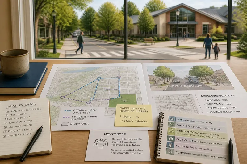
Imagine a fictional neighborhood plan proposing a safer walking route to a library. Its made-up starting details are a goal of improving access, a map showing two possible streets, no selected crossing design, and a note that the design will return to a council committee after consultation.
First, the resident identifies the goal as safer library access, rather than assuming that a particular street has already been chosen. Second, they read the map legend and note that both streets are options. Third, they check the plan’s access notes and see that neither option specifies curb ramps or crossing locations. Fourth, they find the committee named for the next review and confirm that public comments are invited before that meeting.
The resulting answer is concrete: the route and crossing design remain open, the committee is responsible for reviewing them, and the next useful record is the consultation material and the committee paper. If the committee paper names a route and crossing design, residents can assess that proposal; if it does not, they can ask when those details will be considered. The trade-off is that the plan sets a direction without yet settling the design.
For a local plan, the most useful follow-up question is tied to a place residents recognize: which option is still open, who will choose it, and where will the decision be recorded? That question makes the next public record easier to identify and keeps attention on how the plan will change the place people use.