The Local Boundary Myth: One Line, One Community
The local boundary myth treats a map line as a community edge. Learn how to read jurisdictions, everyday routes, and local ties without overlooking affected people.

A municipal border can determine which office maintains a road, but it cannot show everyone who depends on that road. The local boundary myth takes an administrative line as a full portrait of community life, even when the line was drawn to assign a specific public responsibility.
That distinction comes into view around places people share: a library used by residents from neighboring towns, a bus stop at a district edge, or a school whose families travel across several wards. Local communities form through different kinds of connection, and each becomes visible through a different lens.
Jurisdiction assigns duties but does not contain community
Municipal borders, ward lines, school catchments, and service districts help public bodies allocate work. They can identify who maintains a street, elects a representative, or sets eligibility for a service. For those questions, the relevant boundary matters.
It answers a question about authority, not every question about belonging or impact. Someone may live in one municipality, work in another, and bring a child to a sports club in a third. Each location can be accurately mapped, while the person’s daily community extends beyond any one outline.
When a decision concerns a road, for instance, the responsible authority may be clear even if the effects reach people who live outside its jurisdiction. Treating the official boundary as the whole story can leave those connections unmentioned.
Everyday routes connect places beyond official lines
People’s routines create practical networks: the bus route to a job center, a grocery store near a town border, a school pickup path, or a walkway to a riverside park. These connections matter when a local change affects access, travel, or the use of shared places.
A route map can show which stops connect several neighborhoods, but it cannot stand in for everyone’s experience. People who work irregular hours, care for someone at home, or have limited mobility may rely on different paths or use a place less visibly.
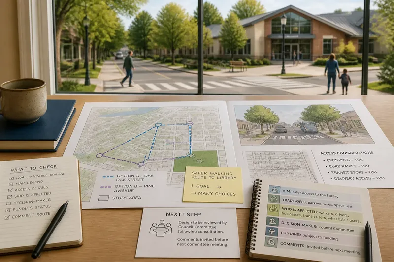
Consider an invented situation: a town is considering a new entrance to a recreation field beside its border. The town first checks its maintenance map and confirms that it controls the field; then it marks nearby bus stops and walking routes on a street map; finally, it asks the recreation group and residents from the adjacent district how they reach the site. The resulting account identifies the town as responsible while showing that visitors from outside its boundary may also need access during construction.
Local ties include relationships that maps rarely show
Family, language, faith, mutual aid, shared experience, and long-standing relationships can connect people across formal borders without following one route or gathering in one place. These ties matter when a decision concerns representation, belonging, or whose experience is being heard.
Listening can bring such connections into view. A neighborhood association, a local nonprofit, or a public meeting may reveal that people organize around a place or concern that does not match a service district. Those conversations should leave room for disagreement: two residents on the same street can describe their community differently.
Identity is not a single label to apply to everyone who lives nearby. Someone may feel attached to a place without living there now, while another resident may feel little connection to the official neighborhood. Treating those accounts as overlapping rather than uniform makes room for a more accurate picture.
Use a boundary only for the question it can answer
Different local maps describe different relationships. A ward map shows electoral representation; a service district can show who is eligible for a program; a transit map shows routes and stops. Comparing them is useful when a decision has a formal owner but affects people beyond that owner’s area.
- Check the municipal or service boundary. If the question concerns legal responsibility or eligibility and the line names the responsible authority, use it for that purpose; if the effect reaches beyond it, describe the affected area separately.
- Check the ward map. If the question concerns elected representation and the map identifies the relevant ward, use it to locate the representative; if the concern is access to a place, also check routes and nearby users.
- Check a transit or street map. If routes connect the affected place to neighboring districts, include those connections in an access discussion; if no relevant route appears, ask users how they travel rather than assuming there is no connection.
- Check who regularly uses the place. If visitors come from outside the jurisdiction, include them when describing practical effects; if use is mainly local, still avoid treating that pattern as proof that everyone belongs to the same community.
- Check whose voices are missing. If a public meeting or group list leaves out people with less visible routines, seek another way for them to contribute; if the missing group cannot be identified, state that the account may be incomplete.
- Check the purpose of each map. If a map was made for a specific service or election, keep its claim within that purpose; if two maps differ, explain that they describe different relationships rather than forcing them into one outline.
These checks do not call for an ever-expanding boundary. They keep the administrative line useful while making clear where it stops answering the question at hand. For formal authority, eligibility, or local rules, consult the responsible agency’s published guidance.
Different local maps answer different questions?
Does a municipal border define a neighborhood?
It defines an area for certain public responsibilities, but neighborhood ties may extend across it or end well inside it. Use the border to identify formal authority, then describe other connections relevant to the issue.
Who should be heard when effects cross a boundary?
Include people who use the affected place or service, not only residents within the responsible authority’s area. Depending on the issue, that may include nearby residents, regular visitors, local groups, or service users.
Can someone belong to more than one local community?
Yes. A person may feel connected to a residential neighborhood, a workplace district, and a group organized around a shared interest. Which connection matters most can depend on the local decision being discussed.
What if maps show different local areas?
They may be mapping different things, such as electoral representation, service access, and everyday movement. Name what each map is designed to show instead of treating one outline as the definitive shape of community.
Describe what the local boundary leaves out
A clear account names the boundary and the job it performs, then distinguishes that from the routes, relationships, or users extending beyond it. That precision helps readers understand why an official line matters without mistaking it for a complete account of local life.
When a local notice names an area, ask whether it is describing responsibility, representation, access, or belonging. The local boundary myth loses its hold when those ideas are kept distinct, and a reader can see which neighboring people may still have a stake in the decision.